Celestial Navigation
- Stem To Go

- Aug 18, 2020
- 8 min read
As one of the most influential and oldest sciences, astronomy is one of many interesting sub-disciplines to research. From staring at Venus from the window to reading about stars in detailed and prolix articles, most are familiar with how people may use celestial bodies as a compass by simply reading them accurately, though not many how to do so, as devouring that information may come across incomprehensible to them.

Celestial Navigation - [What it is | Concepts | Why do we need it | Applications]
Discovered in 1837 by Thomas Hubbard Sumner, the principles of celestial navigation - sometimes dubbed as astronavigation - depend on documenting angles of stars, moons, and the sun relative to the horizon. For it is interesting as it is, celestial navigation is one of the oldest navigational tools in human history, and a technique to determine one's geographical location. Currently, you could probably use a compass or a GPS, or direct yourself with radio navigation or piloting.
However, to apply it successfully, the key rule most navigators follow is to have a reference point. Why is this? The reference point originates from frequently assigning particular stars directions. For instance, the Pole Star was said to be North (hence the name, North Star) and the South Star (namely Sigma Octantis) was said to be characteristic of the Southern Hemisphere. However functional, it didn't really provide an approximate calculation of where you were. After having that said, you should be able to fix at least two reference points (i.e. "the moon and a known star"). Once done, you are able to assess your own angular measurement. Here is a following example quoted from Reload Your Gear:
"It is fascinating to see that the angle between the moon and Regulus, for instance, would be the same in the Indian Ocean as it would be in any other location on earth." -Reload Your Gear
Also from Reload Your Gear, the following video also explains the mathematical applications within Celestial Navigation.
Or, if you prefer a lecture about it, here is also another video for you to refer to for simplification:
Also, when taking into account its antiquity, you have to know that the angular measurements could possibly be flawed. In fact, there is a simple method that involves raising "a hand above the horizon," the arm extended. Because the width of the pinky finger has angle of over 1.5 degrees elevation, coupled with the extended arm, it can be raised "in order to assess the elevation of the sun from the horizontal plane" (Reload Your Gear). For accuracy, the Age of Exploration produced inventions such as the sextant and octant (refer below). The next few videos are a consecutive series in which you can try to apply an accurate measurement:
1. Using a Sextant:
2. Using "The Noon Sight" Process
3. Knowing Accuracy and Precision
4. Knowing The Pole Star
Being able to find the North Star is an important navigational skill because it is the most indicative and essential star characteristic of the North. Now commonly known as Polaris, the North Star is known for its extreme luminosity in the Ursa Minor Constellation. Hence, a way to mark the North Star would be to locate the brightest star in the Ursa Minor Constellation, particularly in the The Little Bear. You could use the so-called "Pointer" stars located in the bowl of the Big Dipper: Dubhe and Merak (Space.com). To find Polaris, draw a line between the two stars (Dubhe and Merak) and extend it from there 5 times. With that, you'd eventually point the North Star.
Depending on your latitude, you could see the North Star:
"From New York it stands 41 degrees above the northern horizon, which also corresponds to the latitude of New York. Since 10 degrees is roughly equal to your clenched fist held at arm's length, from New York Polaris would appear to stand about "four fists" above the northern horizon. At the North Pole, you would find it overhead. At the equator, Polaris would appear to sit right on the horizon." -space.com
However, Polaris is not always constant. Moreover, it will not always be our North Star due to a physics concept otherwise known as Torque, a rotating force caused by gravitational forces of the sun and moon. In consequence, the Earth's axis moves in a process known as precession, which in turn causes the Earth to move in a circular pattern (space.com). Thus, the North Star shifts its place after centuries.
History
The heavens have been recorded as a means to determine where their destination is. As history would have it, old mariners and early navigators relied on stars for their geographical position, considered as one of the oldest means in which the humans could orient themselves.
The following civilizations employed celestial navigation, along with some modern technology within the context of this time (not in chronological order):
+ The Mayans, residing in old Mesoamerica, constructed calendars, navigation methodologies, and temples encompassing the sun, the moon, and Venus (which is the brightest planet you'll see). In short, they mainly used this for determining time and solstices.
+ The ancient Sumerians of Egypt , one of the primary groups who applied this, measured the daily cycle by observing a stick and it's shadows from the sun - which was otherwise known as the Sun Dial. Although functional, it was incredibly flawed with its inability to dictate or ascertain time; this usually happens in the sun's absence, hence rendering the device useless on rainy and cloudy days. Nonetheless, it established the foundation for modern day clocks, the standard 12-hour system.
+ The Mediterranean Sea Minoan Maritimers were dependent on the sun's position relative to its horizon - at its "noonday zenith." The Sea Minoan Maritimers relied on it as an indication of North (and they knew this by drawing a line from the horizon to the center of the sun).
+ To navigate by the stars, there should be a great familiarity with constellations, a group stars that can conjure an illustration by connecting the stars with an invisible line. Even as 12 constellations fill in the sky, thus representing the 12 Zodiac Signs, there are 88 Constellations that brim across the celestial sphere. As it can be inferred previously - and will be covered afterwards- the reading of all suns, moons, and stars worked in tandem with navigation tools with which they could measure angles of the stars (OR moon and sun) relative to its horizon. From there on, early-time navigators could figure the latitude.
+ When the night was clear, explorers could see particular stars to navigate and locate themselves precisely. With their navigation, they used two groups of stars, "The Two Bears," which rotate around the North, therefore orienting themselves differently as seasons change. By simply observing only the bright stars of those groups, Minoan Maritime Navigators could already figure what season it was. Now, "The Two Bears" are what we know now as "Ursa Major" (consisting the Great Bear, Big Dipper, and Plough) and "Ursa Minor" (consisting the Little Bear and Little Dipper).
+In the Age of Exploration , the Arab Empire significantly contributed to the utility of celestial navigation. Transport at sea was essential for their trade networks, especially as they ventured through unfamiliar seas and rivers (such as Euphrates, Tigris, and Islamic Regions). Navigational advancements, such as a magnetic compass and the kamal , a rectangular wooden piece with 9 pieces of consecutive strings knotted to it, were useful. In short, the Arab Empire paired their celestial navigation methodologies with newly constructed technologies.
Although those were a few illustrations, there are other innumerably instances in which celestial navigation was used.
Some Early Navigation Tools
Astrolabe (Mariner's)
The Astrolabe for a mariner in particular was used to take the altitude (distance from the horizon) of the sun, stars, and moon, while also finding the latitude. This type of astrolabe was instrumental in regards to determining time, altitude, and latitude that it was unlike the traditional astrolabe. For further reading on it's uses, click here.

Pixabay, Copyright free
Back Staff
The back staff was a navigational instrument used to accurately measure the altitude. Sailors, therefore, didn't have to look directly at the sun in order to measure the angle of the sun to the horizontal.

Chip Log
This was an early speedometer in which a rope knots at the right intervals to effectively drop the weight overboard (and dragged across the waters) if the ship was underway. Though not a directly linked tool to Celestial Navigation, it was used for ships in order to prepare for Celestial Navigation (and for trades). In addition, a sailor could count the approximate number of knots that were pulled out in order to determine the speed of the ship. (How cool is that?!).

Kamal
Essentially, a kamal involves a piece of wood and string which could "indicate the distance traveled north or south". This was the tool used to measure altitude and determine latitude. For further reading on it's uses, click here.

Mariner's Compass
The navigational instrument was an early version of the Magnetic Compass. There were a few flaws, however, as early sailors noticed that the geographic north was different than the orientation of magnetic north. Because the earth's poles aren't fixed in relation to its horizontal axis, the compass may deviate away from the true direction of your destination, thereby deeming the instrument inconsistent and inaccurate.

Pixabay, Copyright free
Octant
The Octant (or Reflecting Quadrant) is another measuring instrument employed in navigation with which has a similar function as a sextant, though its scale reads up to AT LEAST 90 degrees, or frequently extended to 100 or so forth, whereas a sextant reads up to 120. To know the difference between the Octant and Sextant further, click here.

Sextant
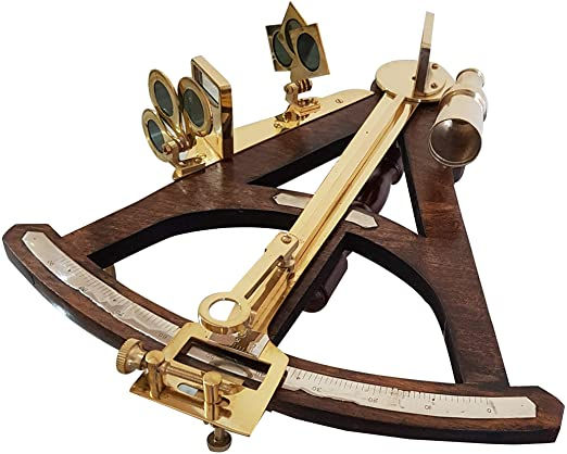
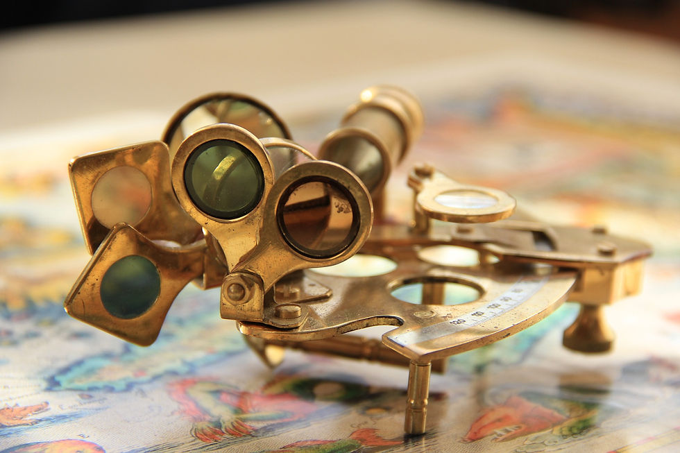
The Sextant allowed explorers to navigate accurately by calculating the angle measurements between the stars, sun, and moon for the latitude. If you want to learn more about its uses/applications, refer to the video above (Getting Started in Celestial Navigation - 1st video).

Pixabay, Copyright free
FOR FURTHER INFORMATION BEYOND THIS ARTICLE, WATCH THESE VIDEOS AS WELL (Recommended To Get The Most Out of This Topic!):
Find Directions Without A Compass! Don't Get Lost! (A Series by AlfieAesthetics)
REFERENCES:
Baird, Sheppard. “Minoan Maritime Navigation.” Minoan Maritime Navigation, www.minoanatlantis.com/Minoan_Navigation.php. Accessed 13 Aug. 2020.
“Kamal - Ages of Exploration.” The Mariners’ Museum Park, 16 Oct. 2018, exploration.marinersmuseum.org/object/kamal.
Linton, Michael. “History of Navigation.” -, 4 Apr. 2013, scholar.googleusercontent.com/scholar?q=cache:ZI5bME888UIJ:scholar.google.com/+F.+W.+Wright,+Celestial+Navigation+(Cornell+Maritime+Press,+Cambridge,+MD,+1976).&hl=en&as_sdt=0,5.
“Mariner’s Astrolabe - Ages of Exploration.” The Mariners’ Museum and Park, 16 Aug. 2018, exploration.marinersmuseum.org/object/astrolabe/#:%7E:text=The%20mariner’s%20astrolabe%20was%20an,of%20the%20sun%20or%20stars.&text=The%20mariner’s%20astrolabe%20was%20an%20important%20navigational%20tool%20for%20finding,find%20altitude%2C%20and%20find%20latitude.
National Geographic Society. “Navigation.” National Geographic Society, 9 Oct. 2012, www.nationalgeographic.org/encyclopedia/navigation.
“Navigating by the Stars.” National Maritime Historical Society, 31 May 2018, seahistory.org/sea-history-for-kids/navigating-by-the-stars.
“Navigation at Sea, History of - Important, System, Marine, Human.” Water Encyclopedia, www.waterencyclopedia.com/Mi-Oc/Navigation-at-Sea-History-of.html. Accessed 16 Aug. 2020.
“Navigation Tools.” The Explorers, Oct. 2007, www2.needham.k12.ma.us/eliot/technology/lessons/explorers/tools.htm#:%7E:text=Celestial%20navigation%20requires%20the%20sailor,tell%20the%20sailor%20is%20latitude.&text=The%20first%20compass%20was%20used,Europe%20about%20300%20years%20later.
Practical Navigator. “Getting Started in Celestial Navigation (Accuracy and Precision).” YouTube, uploaded by Practical Navigator, 1 May 2013, www.youtube.com/watch?v=uNWTN2LQ-TU.
---. “Getting Started in Celestial Navigation (The Marine Sextant).” YouTube, uploaded by Practical Navigator, 6 Apr. 2013, www.youtube.com/watch?v=DrAkrgZRb9Y.
---. “Getting Started in Celestial Navigation (The Noon Sight for Latitude).” YouTube, uploaded by Practical Navigator, 7 Apr. 2013, www.youtube.com/watch?v=BWGOlpj4YwE.
---. “Getting Started in Celestial Navigation (The North Star).” YouTube, uploaded by Practical Navigator, 23 May 2013, www.youtube.com/watch?v=sa_2qF1iCqk.
Rao, Joe. “The North Star: Polaris.” Space, 16 May 2017, www.space.com/15567-north-star-polaris.html#:%7E:text=Polaris%20is%20located%20in%20the,whose%20stars%20are%20rather%20faint.
Reyes, Jeffrey. “The Ultimate Guide To Celestial Navigation – How To Navigate Using The Stars?” Reload Your Gear, 3 Mar. 2019, reloadyourgear.com/the-ultimate-guide-to-celestial-navigation.
TabletClass Math. “Celestial Navigation Math.” YouTube, uploaded by TabletClass Math, 5 Sept. 2012, www.youtube.com/watch?v=XWLZKmPU17M&t=92s.
Tippecanoe Boats. “Celestial Navigation Made Easy.” YouTube, uploaded by Tippecanoe Boats, 16 May 2018, youtube.com/watch?v=-ARXW8InStY.


Comments